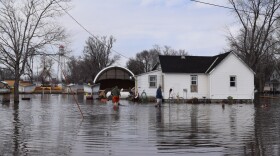
It’s been a year since massive flooding along the Missouri River devastated western Iowa communities. Many are still trying to recover. And forecasters say there's a good likelihood of minor to moderate flooding again this year.
Several dozen people gathered last week in a church hall in Sidney in southwest Iowa’s Fremont County to hear from the National Weather Service of Omaha/Valley, Neb. about what the spring flood threat looks like. David Pearson, a hydrologist with the National Weather Service, led the forum. The U.S. Army Corps of Engineers and the Iowa Department of Transportation were there to help answer questions.
“When you go further north into northeast Nebraska and to South Dakota, North Dakota, they’ve had several wet years in a row which has led to a very high soil moisture condition … that’s where the risk comes from, is the moisture they get obviously affects us down here,” Pearson told the crowd.

This was one of a handful of meetings in southwest Iowa and eastern Nebraska. Pearson said it’s been pretty dry locally lately, but rain is coming. Lowland flooding is “near guaranteed,” he said. The threat of moderate flooding is about 30 percent higher this year, Pearson said, using the Nebraska City, Neb. flood gauge as an example.
“Compared to this time last year, we’re in a much better place,” Pearson told IPR after the forum, “but we still have things to worry about. The high soil moisture and the amount of water in the rivers does lead to an above-normal risk for flooding.”
Because the area is already saturated, Pearson said he expects minor to moderate flooding. That would do some damage to roads and could inundate homes, but not to the same magnitude as last year’s historic flooding.
The hour-and-a-half-long forum put some people at ease, including Jan Zach, who lives near Percival. Last year’s floodwaters spared his home, but inundated his farm.
“I feel safe,” Zach said. “I’m planning on putting in a crop this year.”
Part of why Zach said he’s confident: The breaches on the protective levee systems near him that the Missouri River and its tributaries caused last year are closed.
"I feel safe. I'm planning on putting in a crop this year." -Jan Zach, a farmer who lives near Percival.
On a federal levee near Percival, a dozer pushed some clay into a big pile. The clay will be used to armor the top and riverside face of the levee so it doesn’t erode if water comes up against it.
“In the distance we see side dumps hauling it in, we see scrapers and tractors hauling sand,” said Benton-Washington Levee District Chairman Pat Sheldon as he stood watching the work. “We see cranes that have been driving sheet piling, that are prepping the sheet piling for concrete.”
The words that come to Sheldon’s mind: “Tremendous progress.”
“We’re confident because we have full-height protection. We have a very wide section here where the repair was made,” Sheldon said. “So we have materials to flood fight with and a lot of weight to hold the water.”

All of the breaches on southwest Iowa levees that the U.S. Army Corps of Engineers is responsible for have been closed. These levees have been brought back up to how tall they were before last year’s flooding. The Corps says it will plant grass later this year to help hold down the clay.
Sheldon will monitor the levees in his district. He said he and other levee district members will need to use their best judgement to say whether people need to evacuate.
The Corps stresses that the flood risk remains elevated until the levees are fully repaired. Sheldon said there is an emergency plan if water does rise. The Corps would strengthen the river-side of these levees with loose stones to hold back the water.
Contrast that with the community of Bartlett about 10 miles north of Percival. A nearby levee system was taken out of the Corps’ levee safety program six years ago. The Corps gave it emergency repairs last year, but can’t fully restore the levee because it isn’t authorized to under federal law.
"Nobody wants to come down here anymore." -Bartlett resident Dean Doty
Bartlett had around 50 people before last spring’s flooding. Dean Doty is one of a few people living there today.
“We used to have some big parties here, 4th of July parties,” Doty said. “We’d have 30, 50 people out here. And they’d camp out if they wanted to and we’d have a good time. But nobody wants to come down here anymore."
Floodwaters lifted up Doty’s home, turned it, and moved it at least 5 feet off of its foundation. He is living in a camper nearby, waiting for a buyout.

Doty said he sees no future for his community.
“We’re on life support,” Doty said. “I just don’t know. I think if it floods again it’s just going to be the end of Bartlett, really.”
Doty was at the National Weather Service forum the day before. He said he is nervous about what could happen this spring.
But the weather service says the region has fewer of the conditions that made last year’s flooding so bad. There is less of a snowpack to melt and the ground is not as frozen. This year’s flooding will depend on how much rain comes and where it falls.


