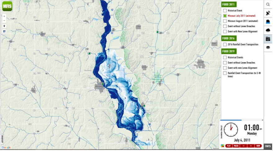
The Iowa Flood Center has developed a new technology to help communities better prepare for flooding along the Missouri River.
The organization created an interactive map that will give real-time information to landowners who may be impacted by flooding. The Missouri River Flood Information System (MRFIS) aims to allow landowners, farmers and businesses to access vital flood information during crises.
“The Corps and the National Weather Service and ourselves, we’re all flood experts, but we can't be there helping every individual homeowner and landowner, they need to help themselves,” Weber said. “We can provide the tools to them that allow them to be able to do that.”
In 2019, floods devastated the homes and businesses of many people in southwest Iowa towns. Weber said, in those cases, people only had a day or two warning in advance of the floods with very limited information on how it would affect their property.
He said the lack of clear information on the extent of the flooding led to unnecessary damage of personal belongings and farming equipment.
“That's what we want to avoid,” Weber said. “Somebody who is active and trying to save their belongings, but doesn’t have the right information to make the right decisions.”
The new system, built on Google Maps, seeks to fill these gaps. MRFIS will use mathematical models and rainfall data in the region to pinpoint how far flooding could extend across the floodplains. Residents can use the system to understand how their individual properties will be impacted.
“If your home happens to be within the area that's flooded, then with your mouse, you can just click by your house, and it'll tell you the depth of water,” Weber said. “All of that is to help people prepare for floods, to respond to floods, to protect your property against flooding. We really think that it will make things much better the next time that it floods along the Missouri River.”

The National Weather Service typically gives information on major forecast locations alongside the Missouri River. But, Weber said this forecast method leaves a portion of the region in the dark on what flooding will look like.
“If you're a landowner or a farmer or homeowner, and you're not near one of those points, then even though they're making a forecast at a point that's 50 miles to the north, or 50 miles to the south, you may have no idea what the flood will look like, at your location,” he said.
The flood prediction tool could also help find solutions to stem flooding in the region. The Iowa Flood Center can use the technology to see how increasing the number of ponds or wetlands in the watershed might reduce future floods.
Weber said the forecasts will help the region prepare for an expected increase of storms due to climate change. By about 2050, there'll be a 20 percent increase in the volume of rainfall that happens during intense storms, according to data from the Iowa Flood Center.
“It’s not a matter of if the region will have another flood like in 2011 or 2019, it’s a matter of when,” Weber said. “It’s critical for people in this area to have access to the information in MRFIS to be able to make informed decisions to reduce their flood threats, now and in the future.”
The Iowa Flood Center received grant funding to improve upon the National Weather Service’s flood forecast system in July of 2020. It is a part of a larger project to assist Fremont and Mills counties, who were heavily impacted by flooding in 2019. BNIM Architects and Planners are working with these areas to provide greater protection against future floods and to encourage business growth.
Weber said he’s hopeful the new flood technology will bring greater protection to these towns in the future.
“We're helping Iowans that need help, that have been devastated by these floods. That's what makes me most proud.”


